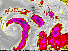
I've spent the last few hours looking over weather maps, models, text outputs, and pictures. I've also chatted with some of the private mets around town. It looks like we are all thinking snow for this weekend. While we haven't nailed down the amount of snow, all the key factors will be in place for snow. We will have modified arctic air coming south from Canada and we will have precip coming off the ocean. Those two mixing can bring snow to all of the metro area. Again, it will all depend on how much precip we have. As we get closer to the weekend, that side of the equation will become much more clear. As for the rest of the week, we will see showers and colder temps. The first wave of colder air moves in tonight over the area. The snow level will bounce between 1000 and 2000 feet until the weekend. We really do need the rain and snow as we are almost 9 inches of rainfall behind the average for the water year. Since January 1st, we are almost four inches behind. I'm not sure if we will be looking at a drought come this summer, but we need all the rain and snow we can get.
Quiz Time ! Who can tell me when the water year officially begins ? Send me your guess at xBobbyAMSPrez@gmail.com ! Just remove the x at the beginning. The winner will get a shout out on the blog.
Wednesday, March 4, 2009
Subscribe to:
Post Comments (Atom)

No comments:
Post a Comment