Tuesday, December 25, 2007

Snow !


Monday, December 10, 2007

KPTV Pics.....


Mark On Air !

Mark Updating The Forecast

Mark Explaing A Weather Event!

Mark Shows The Paper Forecast!

The First Live Local Weather Center!

Mark Watches The Tease!

KPTV Visit...


A few friends made our way over to KPTV this evening to hang out with Mr. Mark Nelsen. He was gracious enough to host us. Here is the group photo without me.

Saturday, December 8, 2007

Coastal Storm Damage Pictures

Steve Pierce, blog contributor and fellow Oregon AMS member has put together a great montage of photos from the coast. Here is link.

Storm Photos

Friday, October 26, 2007

Another Picture

Here is where it broke off.

more pictures.


another picture

another windy fall


So last week it was the neighbors tree that fell and then today a big branch from a tree in my yard fell. Here are two pictures.

Saturday, October 20, 2007

Steve Pierce Winter Forecast

Blog writer and "weather geek" put out his Winter Forecast a few weeks ago. Take a look at it. Steve won't be presenting at the AMS Winter Weather Meeting, but some of his information will make it into a presentation.

Steve Pierce Forecast

Tree Falls In Beaverton

I'm watching another great Saturday of college football when I see a movement of something out of the corner of my eye. I quickly look to the left and see a tree slamming into the house across the street. I grabbed my camera and clicked a few pictures ! The wind was blowing all that hard. I'm guessing the tree rotted and just went over. There were a ton of bees flying around the base. Looks like they will have to find a new home.

Bobby


Wednesday, October 17, 2007

Skywarn and Ham Operator Working to Save Lives !

This an article about a skywarn member in Michigan who is working to save lives.

Thursday, October 11, 2007

Remembering The Mother Of All Storms

Yes thats right. October 12th, 1962...The Columbus Day Storm. This is the measuring stick that all of the pacific storms are judged by. The storm is one of the most powerful to ever strike the United States. Millions of board feet of timber were destroyed and tons of weather stations were taken off line as they were either blown away or hit by debris. I wasn't around in '62, but after watching old news footage, I'm glad I wasn't here to see it in person, I just hope I get to see a storm close to that soon.

Here is a video of the Dec. 12th 2006 storm that brought high winds to the coast and the valley !

Saturday, October 6, 2007

Portland NWS Open House


Today was the NWS open house in Portland. It was a cool event to attend. I was handing out information about the Oregon AMS and just chatting with the forecasters and fellow weather fans. Most of the focus from my stand point was the upcoming wind event on Tuesday. It was very interesting to see the NWS forecasters sort through the information and really explain to all of us the dynamics and the reasons why it might not happen this time. Steve Pierce, blog writer and weather nut also made an appearance. This guy is all about the snow and windstorm. He is a valuable resource to this blog and the others that he posts information. It was very cool to see the different tools that are available to the NWS. I was blown away at the technology that they had at their disposal. I was very jealous that they have all the information available, just a click away. The day started with a quick overall briefing of the national weather service and who they are and what they do. The entire staff was friendly and willing to talk. I was very impressed with them all. I had a chance to sit down with Tyree Wilde, the Warning Coordination Meteorologist from the Portland NWS WFO (Weather Forecast Office) and chat about the new Storm Based Warning System. Move your mouse over the link and the player will appear and click play. To download the interview, simply click the link.


Tyree Wilde Storm Based Warning

Thursday, October 4, 2007

Funnel Cloud in da Couv !

From PDX NWSFO !

SHORT TERM FORECAST NATIONAL WEATHER SERVICE PORTLAND OR 542 PM PDT THU OCT 4 2007 WAZ023-039-040-050115- GREATER VANCOUVER AREA-SOUTH WASHINGTON CASCADE FOOTHILLS- WESTERN COLUMBIA RIVER GORGE- 542 PM PDT THU OCT 4 2007 .NOW... AT 542 PM PDT NATIONAL WEATHER SERVICE DOPPLER RADAR INDICATED A THUNDERSTORM NEAR I-205 AND WASHINGTON HIGHWAY 14...OR ABOUT 8 MILES SOUTHEAST OF BATTLE GROUND...MOVING NORTHEAST AT 15 MPH. A TRAINED WEATHER SPOTTER REPORTED A FUNNEL CLOUD ASSOCIATED WITH THIS THUNDERSTORM. SMALL HAIL...HEAVY RAIN...GUSTY WINDS UP TO 35 MPH...AND DANGEROUS LIGHTNING CAN BE EXPECTED IN THIS AREA.

Photos can be found at the Storm Team 12 Blog ! Storm Team 12 Blog

Wednesday, October 3, 2007

Wild Upcoming Weather ?

I've spent the last half hour looking at maps for Tuesday and Thursday of next week. Many models have deep low pressure systems heading this way. Steve Pierce, blog contributor and fellow weather geek is saying that some models bring it on course for a good wind event, while the Euro takes it out farther in the ocean. Only time will tell. All of us are waiting for the next MM5 run to come in. That will be about 1am pacific. The Drought Monitor conference is next week as well. If the models start to get some consistency on the location of the low and it does infact look like a wind event, you will have a giant gathering of weather people in Portland. That could be a very cool thing to see !

Sunday, September 30, 2007

Record Rainfall and Cloud Seeding In Kansas !

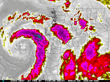
Eugene broke the one day rainfall record for today, September 31st. Portland is close and I will update any other records if they are broken. Here is a story from Kansas City. Looks like they are trying to cloud seed.

Kansas weather modification program relies on ‘cloud seeding’
By MARIA SUDEKUM FISHER
The Associated Press
LAKIN, Kan. | Water is prized in western Kansas, where aquifers are suffering and farms are miles wide and generations deep.

A scant half inch of rain can mean the difference between a successful season and a failed one. But when it comes in the form of fist-sized balls of ice known as hail, water’s more than a menace. It can damage and even destroy crops.

That’s where the Western Kansas Weather Modification Program and other cloud-seeding operations across the western U.S. come in. The program is among about 10 that tinker with the weather — either by trying to cut the size of hail or boost rainfall and snowpack. They do it largely by shooting up storm clouds with silver iodide or dry ice mixtures.

Cloud seeding has a host of critics, from those who say there is no good science to support claims that it works to others who raise concerns about the possibility that it actually may cause less rain and harm the environment.

Cloud seeding was developed after World War II to try to increase rainfall. The theory is that the silver iodide, which has a structure that resembles ice, creates raindrops in the clouds, increasing precipitation and reducing moisture for hail formation.

A measure before the U.S. Senate would allocate $10 million a year to establish an agency that would develop policy and research weather modification programs.

Kansas started its program in 1975. The Western Kansas Weather Modification Program now covers about 8,000 miles and is used about 85 percent of the time for hail reduction. The program, which receives state and local funding, was briefly extended into northwest Kansas in the late 1990s. But residents became concerned that cloud seeding may have been reducing their rainfall amounts and voted the program out.

The program operates from April through September with four planes. Program manager Walt Geiger monitors the weather from a radar station. When he sees a storm developing, one with “lots of strong vertical action” that could be a hail producer, Geiger notifies the pilots, who then head into the storms armed with canisters of silver iodide.

A 1998-1999 study of the Kansas program found that while there was a statistically significant reduction in hail that year, there was no evidence to support the program’s attempts to increase rainfall.

David Brenn, the program’s director, says he has seen the benefits of hail reduction efforts. He also says at least one insurance company has expressed interest in partnering with the program.

But Mike Standley, whose family has farmed in southwest Kansas for about a century, says he’s concerned that cloud seeding may be costing him some precious rain. It has been a long time since he has seen regular summer afternoon thunderstorms on his land, says Standley, 30.

Standley says he would like to see solid proof that cloud seeding works. With 14 to 19 inches of precipitation a year, he just can’t spare the moisture. “I can raise crops with hail,” he said. “But I can’t raise crops with no moisture.”

Wednesday, September 26, 2007

Storm Based Warnings

Starting October 1st, the National Weather Service will begin to issue storm based warnings. A storm based warning is more accurate than a county wide warning. The primary use of the storm based warnings will be for severe weather including thunderstorms and tornadoes. Check out the information from the National Weather Service.


Storm Based Warning Information

Tuesday, September 25, 2007

Its about to get a lot colder

From the NWSFO at Portland. Low snow levels.....chilly temps elsewhere !


SPECIAL WEATHER STATEMENT
NATIONAL WEATHER SERVICE PORTLAND OR
119 PM PDT TUE SEP 25 2007

ORZ011-013-WAZ019-262300-
NORTHERN OREGON CASCADES-CASCADES IN LANE COUNTY-
SOUTH WASHINGTON CASCADES-
INCLUDING THE CITIES OF...GOVERNMENT CAMP...DETROIT...
SANTIAM PASS...MCKENZIE BRIDGE...OAKRIDGE...WILLAMETTE PASS...
COLDWATER RIDGE VISITORS CENTER...MOUNT ST. HELENS
119 PM PDT TUE SEP 25 2007

...SNOW LEVELS LOWERING CLOSE TO CASCADE PASS ELEVATIONS LATE
THURSDAY NIGHT AND FRIDAY...

SNOW LEVELS ARE EXPECTED TO DROP TO NEAR THE ELEVATIONS OF THE
MAIN PASSES THROUGH THE SOUTH WASHINGTON AND NORTH AND CENTRAL
OREGON CASCADES LATE THURSDAY AND FRIDAY. MUCH COOLER AIR
ASSOCIATED WITH AN EARLY FALL LOW PRESSURE SYSTEM WILL SPREAD
ONSHORE LATE THURSDAY NIGHT AND DURING THE DAY FRIDAY. SOME LIGHT
SNOW ACCUMULATION IS POSSIBLE ESPECIALLY FRIDAY NEAR THE PASSES...
WITH SEVERAL INCHES POSSIBLE AT THE HIGHER ELEVATIONS OF THE
CASCADES.

PEOPLE PLANNING ON HIKING...CAMPING...OR CLIMBING IN THE CASCADES
LATE THIS WEEK SHOULD BE PREPARED FOR THE COMING COLD WET WEATHER.


$$

FOR ADDITIONAL WEATHER INFORMATION...VISIT OUR WEB SITE AT
WWW.WEATHER.GOV/PORTLAND

Friday, September 21, 2007

Weather Radio Recalls

The National Weather Service has the recall notice for some Oregon Scientific Weather Radios. Here is the info.

Weather Radio Recall

NWS Open House !

Three of the Pacific Northwest N.W.S. offices are having open houses. Here are the links to office near you !

Portland: October 6th

Medford: September 29th

Spokane: October 6th

Seattle, Pendleton, and Boise don't have an open house scheduled at this time.

Cold Night in Southern Oregon

This is from NWS Medford !


URGENT - WEATHER MESSAGE
NATIONAL WEATHER SERVICE MEDFORD OR
1124 PM PDT THU SEP 20 2007

NORTHERN AND EASTERN KLAMATH COUNTY AND WESTERN LAKE COUNTY-
INCLUDING THE CITIES OF...BEATTY...BLY...CHEMULT...CRESCENT...
GILCHRIST...SPRAGUE RIVER
1124 PM PDT THU SEP 20 2007

...HARD FREEZE WARNING REMAINS IN EFFECT UNTIL 8 AM PDT FRIDAY...

A HARD FREEZE WARNING REMAINS IN EFFECT UNTIL 8 AM PDT FRIDAY.

CLEAR SKIES AND A COLD AIR MASS WILL ALLOW LOW TEMPERATURES TO
FALL BELOW FREEZING LATE TONIGHT. COLDER LOCATIONS SUCH AS
CHEMULT...GILCHRIST...AND CRESCENT WILL SEE TEMPERATURES DROPPING
INTO THE LOWER 20S AROUND SUNRISE.

A HARD FREEZE WARNING MEANS SUB-FREEZING TEMPERATURES ARE
IMMINENT OR HIGHLY LIKELY. THESE CONDITIONS WILL KILL CROPS AND
OTHER SENSITIVE VEGETATION.

Thursday, September 20, 2007

Pacific Northwest Weather

Welcome the Pac NW Weather Blog. Here you will find thoughts and tidbits from the guys that talk weather.

Enjoy !