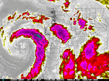
Eugene broke the one day rainfall record for today, September 31st. Portland is close and I will update any other records if they are broken. Here is a story from Kansas City. Looks like they are trying to cloud seed.
Kansas weather modification program relies on ‘cloud seeding’
By MARIA SUDEKUM FISHER
The Associated Press
LAKIN, Kan. | Water is prized in western Kansas, where aquifers are suffering and farms are miles wide and generations deep.
A scant half inch of rain can mean the difference between a successful season and a failed one. But when it comes in the form of fist-sized balls of ice known as hail, water’s more than a menace. It can damage and even destroy crops.
That’s where the Western Kansas Weather Modification Program and other cloud-seeding operations across the western U.S. come in. The program is among about 10 that tinker with the weather — either by trying to cut the size of hail or boost rainfall and snowpack. They do it largely by shooting up storm clouds with silver iodide or dry ice mixtures.
Cloud seeding has a host of critics, from those who say there is no good science to support claims that it works to others who raise concerns about the possibility that it actually may cause less rain and harm the environment.
Cloud seeding was developed after World War II to try to increase rainfall. The theory is that the silver iodide, which has a structure that resembles ice, creates raindrops in the clouds, increasing precipitation and reducing moisture for hail formation.
A measure before the U.S. Senate would allocate $10 million a year to establish an agency that would develop policy and research weather modification programs.
Kansas started its program in 1975. The Western Kansas Weather Modification Program now covers about 8,000 miles and is used about 85 percent of the time for hail reduction. The program, which receives state and local funding, was briefly extended into northwest Kansas in the late 1990s. But residents became concerned that cloud seeding may have been reducing their rainfall amounts and voted the program out.
The program operates from April through September with four planes. Program manager Walt Geiger monitors the weather from a radar station. When he sees a storm developing, one with “lots of strong vertical action” that could be a hail producer, Geiger notifies the pilots, who then head into the storms armed with canisters of silver iodide.
A 1998-1999 study of the Kansas program found that while there was a statistically significant reduction in hail that year, there was no evidence to support the program’s attempts to increase rainfall.
David Brenn, the program’s director, says he has seen the benefits of hail reduction efforts. He also says at least one insurance company has expressed interest in partnering with the program.
But Mike Standley, whose family has farmed in southwest Kansas for about a century, says he’s concerned that cloud seeding may be costing him some precious rain. It has been a long time since he has seen regular summer afternoon thunderstorms on his land, says Standley, 30.
Standley says he would like to see solid proof that cloud seeding works. With 14 to 19 inches of precipitation a year, he just can’t spare the moisture. “I can raise crops with hail,” he said. “But I can’t raise crops with no moisture.”
Sunday, September 30, 2007
Wednesday, September 26, 2007
Storm Based Warnings
Starting October 1st, the National Weather Service will begin to issue storm based warnings. A storm based warning is more accurate than a county wide warning. The primary use of the storm based warnings will be for severe weather including thunderstorms and tornadoes. Check out the information from the National Weather Service.
Storm Based Warning Information
Storm Based Warning Information
Tuesday, September 25, 2007
Its about to get a lot colder
From the NWSFO at Portland. Low snow levels.....chilly temps elsewhere !
SPECIAL WEATHER STATEMENT
NATIONAL WEATHER SERVICE PORTLAND OR
119 PM PDT TUE SEP 25 2007
ORZ011-013-WAZ019-262300-
NORTHERN OREGON CASCADES-CASCADES IN LANE COUNTY-
SOUTH WASHINGTON CASCADES-
INCLUDING THE CITIES OF...GOVERNMENT CAMP...DETROIT...
SANTIAM PASS...MCKENZIE BRIDGE...OAKRIDGE...WILLAMETTE PASS...
COLDWATER RIDGE VISITORS CENTER...MOUNT ST. HELENS
119 PM PDT TUE SEP 25 2007
...SNOW LEVELS LOWERING CLOSE TO CASCADE PASS ELEVATIONS LATE
THURSDAY NIGHT AND FRIDAY...
SNOW LEVELS ARE EXPECTED TO DROP TO NEAR THE ELEVATIONS OF THE
MAIN PASSES THROUGH THE SOUTH WASHINGTON AND NORTH AND CENTRAL
OREGON CASCADES LATE THURSDAY AND FRIDAY. MUCH COOLER AIR
ASSOCIATED WITH AN EARLY FALL LOW PRESSURE SYSTEM WILL SPREAD
ONSHORE LATE THURSDAY NIGHT AND DURING THE DAY FRIDAY. SOME LIGHT
SNOW ACCUMULATION IS POSSIBLE ESPECIALLY FRIDAY NEAR THE PASSES...
WITH SEVERAL INCHES POSSIBLE AT THE HIGHER ELEVATIONS OF THE
CASCADES.
PEOPLE PLANNING ON HIKING...CAMPING...OR CLIMBING IN THE CASCADES
LATE THIS WEEK SHOULD BE PREPARED FOR THE COMING COLD WET WEATHER.
$$
FOR ADDITIONAL WEATHER INFORMATION...VISIT OUR WEB SITE AT
WWW.WEATHER.GOV/PORTLAND
Friday, September 21, 2007
Weather Radio Recalls
The National Weather Service has the recall notice for some Oregon Scientific Weather Radios. Here is the info.
Weather Radio Recall
Weather Radio Recall
NWS Open House !
Three of the Pacific Northwest N.W.S. offices are having open houses. Here are the links to office near you !
Portland: October 6th
Medford: September 29th
Spokane: October 6th
Seattle, Pendleton, and Boise don't have an open house scheduled at this time.
Portland: October 6th
Medford: September 29th
Spokane: October 6th
Seattle, Pendleton, and Boise don't have an open house scheduled at this time.
Cold Night in Southern Oregon
This is from NWS Medford !
URGENT - WEATHER MESSAGE
NATIONAL WEATHER SERVICE MEDFORD OR
1124 PM PDT THU SEP 20 2007
NORTHERN AND EASTERN KLAMATH COUNTY AND WESTERN LAKE COUNTY-
INCLUDING THE CITIES OF...BEATTY...BLY...CHEMULT...CRESCENT...
GILCHRIST...SPRAGUE RIVER
1124 PM PDT THU SEP 20 2007
...HARD FREEZE WARNING REMAINS IN EFFECT UNTIL 8 AM PDT FRIDAY...
A HARD FREEZE WARNING REMAINS IN EFFECT UNTIL 8 AM PDT FRIDAY.
CLEAR SKIES AND A COLD AIR MASS WILL ALLOW LOW TEMPERATURES TO
FALL BELOW FREEZING LATE TONIGHT. COLDER LOCATIONS SUCH AS
CHEMULT...GILCHRIST...AND CRESCENT WILL SEE TEMPERATURES DROPPING
INTO THE LOWER 20S AROUND SUNRISE.
A HARD FREEZE WARNING MEANS SUB-FREEZING TEMPERATURES ARE
IMMINENT OR HIGHLY LIKELY. THESE CONDITIONS WILL KILL CROPS AND
OTHER SENSITIVE VEGETATION.
Thursday, September 20, 2007
Pacific Northwest Weather
Welcome the Pac NW Weather Blog. Here you will find thoughts and tidbits from the guys that talk weather.
Enjoy !
Enjoy !
Subscribe to:
Posts (Atom)